See our right-hand column for announcements and news briefs. Scroll down the right-hand column to access the Archives -- links to articles posted in the main column since 2007. See details about our site, including a way to comment, in the yellow text above the Archives.
Showing posts with label Torch Lake Superfund site. Show all posts

Wednesday, December 16, 2020

Residents concerned over City of Houghton proposed re-zoning along Canal Road; wetland, Cole's Creek to remain protected in R-1 zoning

By Michele Bourdieu
 
This photo illustrates the potential location of a large hotel that could be built on the Portage Canal along Canal Road in Houghton, should the present residential (R-1) zoning be changed to business (B-2) zoning, according to a rezoning proposal being considered by the City of Houghton. Such a construction project would be allowed by B-2 zoning, assuming all EPA requirements were followed since the area is on part of the Torch Lake Superfund site, next to the home of John and Bonnie Fodermaier, at right. (Photo taken from Hancock side of Canal © and courtesy John Fodermaier)

HOUGHTON -- Concerned local residents have recently raised objections to a proposed rezoning -- from single-family residential (R-1) to community business (B-2) -- of an area under the Torch Lake Superfund bordering on the Portage Canal and Canal Road in Houghton.

Proposed Ordinance 2020-314 to rezone this area was added to proposed Ordinance 2020-315 to rezone another parcel on Canal Road, near the UPPCO building, for the Isle Royale Seaplane Service. Residents have concerns about potential development on a Superfund site and about noise pollution from the plane, which now takes off from a site on Dollar Bay. The two proposals are being considered together.

New agreement protects wetland, Cole's Creek from rezoning

Before last Friday, Dec. 11, the proposed Ordinance 314 also included rezoning a wetland and area along Cole's Creek, a well known trout stream, near Canal Road. However, a Dec. 11 agreement between local resident John Fodermaier -- whose property is next to the wetland on the west and a potential development east of his home -- and owners of the adjacent properties, JRG Development and the Jukuri family, removes the wetland and Cole's Creek area, presently zoned R-1, from the rezoning proposal.

This panorama shows the wetland bordering John Fodermaier's property on the west side. It was certified as wetland under the Michigan Department of Environment, Great Lakes and Energy (EGLE), formerly DEQ. (Photo © and courtesy John Fodermaier)
 
Fodermaier said he was pleased with the removal of the wetlands and Cole's Creek from the proposed Ordinance 314.
 
"I'm looking forward to seeing what comes of this," Fodermaier said. "In the light of the fact that JRG excluded the wetlands -- including Cole's Creek -- from their rezoning request and added deed restrictions for the development, I have removed my opposition to proposed Ordinance 314," Fodermaier said this week. "I applaud JRG for listening to the concerns of the community on this important issue."
 
Here a part of the wetland borders the Portage Canal on the west side of John Fodermaier's property. (Photo by Keweenaw Now)
 
Bill Deephouse, former fisheries biologist, was also happy to hear about the recent agreement between Fodermaier and the Jukuris.
 
On Dec. 14, Deephouse told Keweenaw Now, "I'm pleased that there won't be a zoning change for the wetlands and Cole's Creek."
 
During the Dec. 2 Houghton City Council meeting, Deephouse had commented on the value of the creek as a trout stream.

"I think the proposal to rezone the area from the possible seaplane base near Old Mill Road down the shoreline to Cole's Creek is irresponsible," Deephouse told Keweenaw Now after that Dec. 2 meeting. "Cole's Creek was found to be an excellent stream with good numbers of rainbow trout, coho salmon, brook trout and a few brown trout. As I recall, we estimated that there were 4 year-classes of rainbows in one survey with good numbers of young-of-the-year brook trout. This stream is a natural hatchery and very valuable. The insect population and species composition indicates it is a stream of the highest order."

This photo, taken in May 2018, just before the Father's Day flood, shows Bill Deephouse smelt dipping at 7:30 in the morning on Cole's Creek. "Smelt dipping is usually done at night, often in the middle of the night -- at 2 or 3 in the morning," Deephouse said. "But they were running really heavy and stayed in the creek all night and I was there to catch some in the daytime." (Photo  Marcia Goodrich and courtesy Bill Deephouse)

Deephouse participated in surveys of Cole's Creek in the past to determine its quality as a Type 1 trout stream. However, since the 2018 flood, the creek has suffered damage to its fishery.

"I would have to resurvey the stream again to determine if it still contained the previous numbers and species of fish as found in the past," Deephouse said. "It sustained significant habitat damage and might take some time to return to its former status."

New public hearings to be scheduled for 314, 315

During the Nov. 17, 2020, meeting of the Houghton Planning Commission, following two public hearings to discuss proposed zoning ordinances 2020-314 and 2020-315, the Commission voted to recommend both ordinances to the Houghton City Council. At that time the wetland and Cole's Creek were still included in the 314 rezoning proposal.

Eric Waara, Houghton City Manager, told Keweenaw Now Tuesday, Dec. 15, that the public hearings on the proposed Ordinances 314 and 315 -- originally scheduled for Jan. 13, 2021 -- will now have to be re-scheduled because of the recent agreement to exclude the wetland and Cole's Creek from 314.

This map shows the area of the wetland and Cole's Creek (purple) that has been removed from the original proposed Ordinance 314 so that it may remain in R-1 (residential zoning). The yellow area is proposed to be rezoned from R-1 to B-2 (community business). Click on image for larger version. (Map courtesy City of Houghton)

"We may have a special Planning Commission meeting in early January to set the public hearing date -- and no more, no less (on the agenda)," Waara said. "That way we can public notice the hearings correctly." 

While that special meeting would have a limited agenda, the public is always welcome to make public comments on any issue during any meetings, he explained. Waara noted he wanted to make clear the distinction between a rezoning request and a proposal for a project. In other words, while a B-2 zoning allows certain types of development, it is not a permission to build something that may require specific permits or restrictions.

"There is a difference between a rezoning request and someone's proposal to do a project, and right now no one has proposed to do a project," Waara said. "This is a single rezoning request. That's all it is."

While the seaplane request was a separate rezoning request last year (It was a proposal to rezone from R-1 to Industrial, but failed), it is connected to the 314 request now; and both are requests to rezone to B-2.

"I'm assuming the owner of the Isle Royale Seaplane Service worked with his neighbors to come up with a mutually agreable and complementary rezoning request," Waara said.

Since the seaplane will be on federal waters, it will be subject to rules, regulations and permitting -- none of which have anything to do with the zoning there, he added.

Residents concerned about potential development to follow rezoning

Before the recent change in the proposed Ordinance 314, John Fodermaier had spoken at City of Houghton Planning Commission and City Council meetings on potential development that the B-2 zoning could allow near his house on Canal Road.

This photo shows John Fodermaier's house at far left and vegetable garden (needing sunshine) toward the center. The Portage Canal is in the background. Lines are drawn to show where a large hotel could be built near his property line if the area is rezoned. (Photo © and courtesy John Fodermaier)

During the Nov. 17 Planning Commission public hearing on proposed Ordinance 314, Fodermaier noted the property being proposed for rezoning included both a protected wetland and a Superfund site. He said he believed the uses that rezoning to B-2 would allow would be prohibited because of the protected status of the area. He also told the Commission that one cannot dig down more than 12 inches on his property without hitting water.*

During the Dec. 2, 2020, City Council meeting, Fodermaier spoke about his concerns that his property could be surrounded by a large hotel of an unspecified number of storeys, a parking lot, and other related businesses in what was intended to be a residential neighborhood when he and his wife, Bonnie, both graduates of Michigan Tech, moved to Houghton for retirement.

"This is an environmentally sensitive area that is also surrounded by R-1 and has existing R-1 single-family homes inside of it," Fodermaier told the Council on Dec. 2, noting this would probably be a bigger development than just a "mom and pop" 15-unit motel. "Think about a 10-storey Hyatt Regency, Marriott or Sheraton -- complete with a restaurant, bar and a 200-car parking lot. Think not about seasonal operation but an operation that's 24 hours a day, 7 days a week, 12 months of the year with boisterous restaurant patrons exiting at midnight or 2 a.m. on the weekends. Think about 300 to 400 more vehicles per day on Canal Road. Think about the excavation required for this type of structure in the hazardous material of the Superfund site. Think about potential encroachment on protected wetlands and Cole's Creek and think about the effect this could have on a Type 1 trout stream at Cole's Creek."

Zoning changes for Ordinances 314 and 315 were proposed at the Oct. 27, 2020, Planning Commission meeting. According to the minutes, "City Manager Waara presented a map of the parcel owned by JRG Development and the Jukuri family along with the area owned by Isle Royale Air on Houghton Canal Road. The owner of the JRG Development/Jukuri property is asking for a conditional rezoning from R1 to B-2 with conditions. The conditions are everything up to B-2 plus hotels, motels, and restaurants and taverns.

"The owner of the Isle Royale Air property is requesting rezoning from R-1 to Industrial with conditions to run a seaplane business."**

Since that meeting the seaplane business is being proposed for a zoning change to B-2 (see above).

Local residents on both sides of the canal are concerned about noise from the seaplane and about its potential impact on water activities on the Portage Canal.

This map and overlay shows potential impacts should proposed Ordinance 315 be adopted to allow the Isle Royale Seaplane Service to operate on the Portage Canal as illustrated. The overlay shows the projected float plane activity area, its proximity to established residential areas and existing recreational silent sports on the canal, which includes part of the Keweenaw Water Trail. (Map courtesy Jennifer Norkol)

Hancock residents Jennifer and John Norkol are among those expressing concerns about the Seaplane business during public comment periods at recent City of Houghton meetings.

"We oppose the proposed zoning changes in Ordinances 314 and 315 from R-1 to B-2," the Norkols told Keweenaw Now in an email Dec. 15. "We and our surrounding community use this waterway for fishing, kayaking, swimming and boating. We live on the lake directly across from this site at 1404 Jasberg Street in Hancock. The noise, increased marine traffic and congestion these planes would cause is of grave concern to us. The Federal Aviation Agency (FAA) defines Seaplane businesses as Airports. We strongly object to the introduction of an Airport in what is currently a residential and recreational area. The City of Houghton planning commission was, in part, to consider if the land use will not be detrimental to the neighborhood or public health and welfare. We believe the Seaplane business relocating to this area to be a detriment on many levels -- to the peace of neighborhood and waterway, lower property value due to increased noise and nuisance, and safety issues with common fishing, boating, (tubing, waterskiing, swimming) and kayaking. These changes now include commercial construction on the adjoining parcel, further impacting the environment.

"We appreciate that the City of Houghton is not under any obligation to act on our behalf as residents of the City of Hancock, specifically the lakefront homes directly across from the proposed site; but as part of a larger community that will be impacted by these proposed changes, we sincerely hope that they will." 

This map of the proposed location for the Isle Royale Seaplane Service shows the area to be changed from R-1 to B-2 zoning if Ordinance 315 is adopted. (Map courtesy City of Houghton) 

The Norkols added their concern about potential pollution from development on the 314 parcel, but for them the Seaplane business poses a greater potential impact on their property value and peace.

Ordinance 314 parcel under Superfund regulations

The proposed Ordinance 314 parcel includes part of the Torch Lake Superfund site. It contains mining waste from the former Michigan Smelter, which operated from the early 1900s to 1948.

This aerial view shows the area of the Michigan Smelter site under the Torch Lake Superfund. The light grey, striped area marks the covered tailings. This area appears to include the area proposed for rezoning to B-2 under Ordinance 314. (Screenshot from EPA Fact Sheet, August 2012)

The mining waste (contaminated tailings) at the various Torch Lake Superfund sites received a soil and vegetative cover to prevent inhalation or contact with contaminants and to reduce erosion of these contaminants into the lake. A 1992 Record of Decision from EPA (Environmental Protection Agency) required deed restrictions to ensure that mine tailings and/or slag material are ultimately re-vegetated after any activity which disturbs the soil cover. Any construction on this site would have this requirement to prevent heavy metals and other contaminants still in the slag from escaping into the air and water. If disturbance occurs, the owner must replace the soil and repair the vegetative cover.***

John Slivon, a concerned Hancock resident, commented on the potential for dangerous air pollution should construction in the area of the proposed Ordinance 314 disturb the Superfund cover.

"The Houghton Superfund site where the construction of a hotel is being planned is, in my opinion, a misguided idea," Slivon told Keweenaw Now. "The Superfund site requires being covered to keep the dangerous material at that site from polluting the air downwind of the site. Construction at that site will result in removing the protective cap and the creation of enormous quantities of contaminated dust blowing into downtown Hancock and Houghton.

"The residential areas of both cities are a scant half mile from the proposed (314) site and directly downwind in the summer, when construction will take place. These downwind areas can't avoid being contaminated by that dust, and the contamination will become a permanent feature in and on the soil of those areas downwind of the construction site. The contaminated dust will almost certainly blow onto the Chutes and Ladders playground. Is the City of Houghton unaware of the dangers that it wishes to inflict on the health of the residents and visitors of Hancock and Houghton?

"While it may seem as if I am over-reacting to this potential opening of the Superfund cap, everyone should be aware that air pollution caused lung disease is the fifth leading cause of death in the U.S. We have done a very good job of cleaning up the air in this area by capping those sites that were most contaminated, thus making it a safer place to live. Why ruin all that progress? We should at least know what's in that contaminated soil before blowing it across our cities. If that soil is at all toxic, then this hotel-on-a-Superfund-site-idea should be abandoned."

According to EPA, the remediation of the Michigan Smelter area was completed in 2003. Although it was deleted from the National Priorities List, this area has not been delisted from Superfund. Landowners must be responsible in protecting the soil and vegetative cover. EPA Region 5 in Chicago partners with EGLE (Michigan Environment, Great Lakes and Energy) in conducting Superfund site visits and in reporting on the  status of remediation every five years.***

Notes:

* See Minutes for Nov. 17, 2020, Houghton Planning Commission.

** See Minutes for Oct. 27, 2020, Houghton Planning Commission.

*** See the EPA's Fourth Five-Year Report for the Torch Lake Superfund Site, Houghton County, Michigan.

Editor's Note: Keweenaw Now attempted to contact EGLE staff and EPA for more details on the contaminants under the Superfund cover in the 314 area. EPA replied they would communicate on this at a later date. EGLE staff did not yet answer calls. Watch for a follow-up story on this issue.

Monday, June 13, 2016

Students learn environmental stewardship through planting, monitoring, birding at Torch Lake Superfund site

By Michele Bourdieu

Lake Linden-Hubbell High School science teacher Nick Squires shows his biology students how to  plant dark-green bulrush and red-osier dogwood near the shore of Torch Lake during their field trip in May 2016. (Photos by Keweenaw Now unless otherwise indicated)

LAKE LINDEN -- Despite some chilly, windy weather and predictions for snow in mid-May, Lake Linden-Hubbell High School 10th grade students spent an afternoon on the shores of Torch Lake planting red-osier dogwoods and dark-green bulrushes, bird watching and installing nesting boxes for birds, and playing disc golf just for fun.

This is just one of several hands-on, outdoor activities their science teacher, Nick Squires, offers his students each year so they can learn about the local ecology and stewardship practices in an area that has been disturbed by mining waste and remediated as a Superfund site. Earlier in the year these students monitored the Lake Linden Village Sands (where the Torch Lake Superfund covered stamp sand from mining with vegetation) and collected data for the Environmental Protection Agency (EPA). In addition, Squires had his eighth graders monitor the Trap Rock River at four different sites.

For the spring field trip, sponsored by the Lake Superior Stewardship Initiative, students were divided into three groups and spent a half hour or more on each of the three activities.  

Linden-Hubbell High School students plant red-osier dogwoods near the shore of Torch Lake on May 13, 2016.

As he demonstrated to his biology students how deep to plant the red-osier dogwoods, Squires noted one area near the shore presented challenges.

"We're standing on rock, for the most part," he said. "You cannot over-water these once they've been planted. If we get some snow tomorrow that will help."

Micah Hornat, right, meets the challenge of digging in rocky soil as Hunter Blau prepares to plant a red-osier dogwood.

Kali La Vigne, left, digs a hoe for a red-osier dogwood plant near the shore. She is assisted with the planting by Emily Beveridge, center, and Alli Goldsworthy.

Nicole Liimatainen holds the red-osier plant in place as Ryan Heikkinen adds topsoil.

Student Laura Lyons was proud of planting the dogwood and bulrushes, which help prevent erosion along the shore and contribute to species variety.

"It's nice to give back to our community," Lyons said.

While Squires led one group in planting, Dana Richter, Copper Country Audubon Club president, led a second group of students in a birding activity -- first observing birds with binoculars and then installing nesting boxes for them in an area near both the Lake Linden water treatment ponds, where many birds gather, and the shore of Torch Lake. Richter said the nesting boxes will be used by many tree swallows in the area.

Students use binoculars to observe birds near the Lake Linden water treatment ponds (at left).

Dana Richter of Copper Country Audubon demonstrates how to dig a hole for a nesting box.

Students take turns digging the hole and installing the nesting box at the right depth -- about 18-24 inches.

Pausing for a photo after completing their nesting box installation are, from left, Sophie Codere, Jake Marcotte, Shay Holzberger and Laura Lyons.

The third group activity, disc golf, was just for fun this year, while last year it was combined with writing poetry.

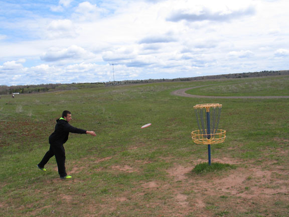
Logan Muljo tosses a frisbee into one of the disc golf basket destinations.

"We're out here just having fun right now," said Logan Muljo, who seemed to be enjoying the exercise while waiting for his group to be called for one of the other two activities.

Instead of playing disc golf, these students preferred hanging out with their English teacher, Heather French, and enjoying the cake she brought for them. Pictured here, from left, are Alli Goldsworthy, Emily Beveridge, Aidan Stahl, Ms. French, Julia McFarland, Lauren Barkell and Kali LaVigne.

Additional projects: monitoring and collecting data

Nick Squires noted his 10th-grade biology class also monitored the Lake Linden Sands last fall. The project follows EPA collection procedures for Superfund monitoring. After establishing up to 25 sample plots, students center a one-meter square (PVC) quadrat on each sampling point and divide the quadrat into quarters. The sampling is done in each quarter as follows:
  • NW corner: Collect plant biomass and measure root penetration
  • NE corner: Collect soil samples for fertility testing in lab
  • SW corner: ID every plant and collect plant vouchers
  • SE corner: Estimate overall soil coverage by vegetation   
The students follow detailed instructions for the sampling collection procedures.

"We have, in the past when they wanted it, submitted this data to the EPA," Squires said.

Each year Squires' 8th graders monitor the Trap Rock River.

Lake Linden-Hubbell 8th grade Earth Science students look for macroinvertebrates in the Trap Rock River. (Photo courtesy Nick Squires)

"We get data on dissolved oxygen, copper, pH, temperature, width, depth, flow rate, velocity, and macroinvertebrate count," he explained. "Historically, out of the 4 monitoring sites, the only spot that has some minor issues is the Scales Creek (tributary of the Trap Rock) site."

Collected macroinvertebrate samples from the Trap Rock River. (Photo courtesy Nick Squires)

Squires said he believes the students' experience in EPA monitoring and planting has many positives.

"It gets them out of the classroom and into the field doing real science," he noted. "It piques their interest in research-based science. The monitoring combined with the planting gives them a real sense that they have an understanding of their local environment as well as a genuine feeling of stewardship (the goal!)."

In early 2003, EPA sought the cooperation of educators and enlisted the assistance of local high school students to continue the monitoring begun by EPA in the first year following the re-vegetation of the Torch Lake site. Students from five area schools now perform long-term monitoring of bird and plant diversity and soil fertility on post-cleanup portions of the Torch Lake Superfund site.

Coordinated by Michigan Tech's Center for Science and Environmental Outreach, along with EPA and the U.S. Fish and Wildlife Service, the students’ monitoring assists EPA’s efforts in charting the progress of the vegetation cap and habitat reconstruction done under the Superfund program. This project is the first of its kind to utilize students for the collection of data for use by EPA.

"Engaging students in learning about, and contributing to, the improvement of their local environment and community, is an excellent way to create lifelong natural resource stewards," observed Joan Chadde, director, Michigan Tech Center for Science and Environmental Outreach, and a partner on the Lake Superior Stewardship Leadership Team.

Funding for the initial year of the students’ work was provided by local groups, but EPA is now paying for the remaining years of the agreement. Cooperating UP-area high schools are Hancock, Lake Linden-Hubbell, Chassell, Dollar Bay, and Calumet.

Wednesday, March 16, 2016

Conservation District to hold Public Meeting on Torch Lake Watershed MARCH 23 in Lake Linden

This map shows the extent of the Torch Lake Watershed. (Image courtesy Houghton Keweenaw Conservation District)

UPDATE: Because of inclement weather, the Torch Lake Watershed Project meeting has been POSTPONED to Wednesday, March 23. It will be held from 5 p.m. to 7 p.m. at the Lake Linden-Hubbell School auditorium.*

LAKE LINDEN -- The Houghton Keweenaw Conservation District (HKCD) will host a public informational meeting on the Torch Lake Watershed Project from 5 p.m. to 7 p.m. on Wednesday, MARCH 23, at the Lake Linden-Hubbell School auditorium.

Carol MacLennan, Michigan Tech professor of anthropology, presents a history of pollution problems in the Torch Lake Watershed at the Feb. 10 Torch Lake Watershed Project meeting in Lake Linden. (Photo by Keweenaw Now)

This meeting will provide information on previous restoration work along Torch Lake and additional water quality information. Guest speakers will review the history of Superfund work, current sediment mercury levels, fish consumption recommendations, an update on the state and regional Area of Concern meeting and next steps to take to continue remediation of Torch Lake.

This meeting is open to all interested individuals. RSVP is appreciated but not required. Please call (906)482-0214 or email meral.jackson@macd.org to notify Meral Jackson of HKCD that you will attend.

Funding is provided by the Areas of Concern Program, Office of the Great Lakes (OGL), Michigan Department of Environmental Quality.

*Editor's Note: We originally announced the date of this meeting as March 16. We have updated it to March 23, as requested by Houghton Keweenaw Conservation District.

Monday, January 18, 2016

Michigan Tech Prof. Carol MacLennan to speak on "Mine Polluted Waters" at Carnegie Museum Jan. 19

Michigan Tech Professor Carol MacLennan will discuss "Mine Polluted Waters: What are our Options?" Tuesday, Jan. 19, at the Carnegie Museum. Click on image for larger version. (Poster courtesy Carnegie Museum)

HOUGHTON -- The Keweenaw Natural History Lecture Series at the Carnegie Museum will present "Mine Polluted Waters: What are our Options?" a lecture by Carol MacLennan, Michigan Tech professor of anthropology and Dept. of Social Sciences graduate director, on Tuesday, Jan. 19. Refreshments and introductions begin at 6:30 p.m., and the lecture and discussion will be from 7 p.m. to 8 p.m. in the Community Room downstairs.

Professor Carol MacLennan speaks about Torch Lake issues during the July 30, 2015, Keweenaw Geotour, "Copper Mining Waste of Lake Superior Today," on Michigan Tech's Research Vessel Agassiz. Bill Rose, Michigan Tech professor emeritus in geology, led the series of educational tours for the public last summer. Highlights of this tour included visits to the Gay and Torch Lake stamp sands. (Photo by Keweenaw Now)

The Keweenaw's experience with the Torch Lake Superfund Site and Area of Concern raises questions as to how we can better understand the mechanisms and government programs we have at our disposal to clean up our watered environment and prevent future pollution. What strategies have worked in other communities? How can we navigate complicated programs and technical issues in order to protect human health and restore the environment. This seminar and discussion will examine our history of pollution, untangle the various efforts to clean it up, and introduce some new ideas for addressing the issues.

Wednesday, June 03, 2015

Photos: Lake Linden-Hubbell students learn stewardship, birding, more near Torch Lake

By Michele Bourdieu

Nick Squires, Lake Linden-Hubbell High School science teacher, explains to students how to plant Red osier plants along the shore of Torch Lake at the Lake Linden Sands, site of the Superfund stamp sand remediation. The student project, on May 15, was sponsored by the Lake Superior Stewardship Initiative. (Photos by Keweenaw Now)

LAKE LINDEN -- Students from Lake Linden-Hubbell High School biology and English classes spent an afternoon of hands-on science activities, combined with a game of disc golf and poetry writing, on May 15, 2015, at the Lake Linden Sands Superfund site, where vegetation now covers stamp sand -- a waste product left by the copper industry.

The students were divided into three groups, each one having an opportunity to do all three activities: planting Red osier plants along the Torch Lake shoreline and learning the benefits of planting native plants in a disturbed area, birdwatching and setting up bird nesting boxes, and playing a game of disc golf combined with a poetry writing exercise.

Planting Red osier near Torch Lake shoreline ...

Lake Linden-Hubbell High School biology students listen as their science teacher, Nick Squires, demonstrates how to plant Red osier dogwoods in the remediated Lake Linden Sands during a Lake Superior Stewardship Initiative project on May 15, 2015. (Video by Keweenaw Now)

The planting activity is only one part of the project, according to Nick Squires, science teacher, who said both biology and chemistry students are involved in the native plant study. In the fall, students did monitoring for the Environmental Protection Agency (EPA), which oversees the Superfund site.

"We do some of the analysis in class," Squires said.

For example, the students have measured plant biomass, plant diversity (the presence of different species), root depth, and air temperatures compared to temperatures right on the ground.

"The chemistry class gets involved by doing the soil analysis," he added.

Students, from left, Bailey Haller, Kirsten Codere and Alexa Destrampe, dig holes for planting Red osier along the shore.*

Both boys and girls used shovels to dig holes for the plants, learning they had to find a spot with fewer rocks in the soil.

"We've never planted these here before, but we did a field analysis here," said Alexa Destrampe. "We took soil samples and tested biomass and root depth in the fall."

Bailey Haller had no trouble digging his hole and planting the Red rosier bush.

"This is the third time I've done this," he said.

Bailey Haller finishes planting his Red rosier bush.

These students finished their planting with no difficulty. Pictured here are, from left, Brendan Sullivan, William Hornat, Gavin Jeffery, Bradley Moilanen and Shane Poisson.

Squires said the EPA, under the Superfund, planted other types of vegetation to cover the stamp sand. The purpose of the student project is to extend that vegetation with the native Red rosier plants to help prevent erosion along the shore and add species variety.

Red osier are planted near the shore to help prevent erosion.

Birding and more ...

The second science activity of the day was an opportunity to observe bird species in the area and set up bird nest boxes for them. Dana Richter, Copper Country Audubon Club president, was on hand to help the students.

Digging the hold for the bird box presents a challenge. It has to be 18 inches to 2 feet deep. Here Emma Sarazin tries digging with the auger. Also pictured in her group are, from left, Elijah Norman, Brendan Middleton and Madison Butkonen.

Students finish digging a hole and setting up a nest box for birds near the holding ponds of the Lake Linden sewage treatment system. At right, Dana Richter, Copper Country Audubon Club president, supervises. Richter said the boxes would probably be used by migrant tree swallows or possibly bluebirds, although there are fewer bluebirds than swallows in the area.

Pictured here with the bird nesting box they installed are, from left, Jordan Craig, Jeff Keranen and Owen Mattila. Jeff is the son of Amy Keranen, Department of Environmental Quality (MDEQ) Remediation and Redevelopment Division project manager for the Abandoned Mining Wastes (including PCBs) project at Torch Lake.

Owen Mattila said it was fun to learn about the native plants and the birds.

"We learned some new types of birds and we dug the bird houses for the tree swallows," Mattila said. "Putting the bird house in -- that was the most fun."

Swallows fly around or land on one of the nest boxes set up by the students. According to Dana Richter, one pair of birds will use one box for nesting.

Students look through binoculars to observe various species of birds. Some of the students had never used binoculars or done any birding previously. Binoculars are lent to the students by Joan Chadde of the Western U.P. Center for Science, Mathematics and Environmental Education.

Birds line the fence at the Lake Linden holding ponds. Dana Richter called students' attention to an uncommon duck near the ponds -- a Northern Shoveler. They also observed a Bonaparte's Gull and some Ring-Billed Gulls.

"It's a wonderful place for birding," Richter said.

Disc golf and poetry ...

The third activity of the day was a game of disc golf. At each hole of the course, students were asked on a handout to pause and answer a question, describing in detail something they saw, heard, tasted, smelled, etc. The assignment was to put these elements together at the end of the course and create a nature poem. Heather French, Lake Linden-Hubbell English teacher, supervised the activity.

This group of students paused for a photo during their game of disc golf. Pictured, from left, are Brent Basto, Lincoln Klein, Steven Suhonen, Kirk Strietes and Billy Brinkman.

At the end of the two-hour afternoon session, Nick Squires called for volunteers from the disc golf group and others to help plant 50 more Red osiers in a nearby wetland.

Students finish the afternoon project by planting -- in record time -- 50 more Red osiers in a wetland near the shore.

"This is perfect weather for planting (cloudy with moist soil)," Squires said.

Beth Squires, Nick's wife, and their son, Rowan, now age 3, enjoyed the outing with the students. "He helped Daddy plant trees," said Beth, who has also been a science teacher.

Nick Squires said students study other areas in the Torch Lake watershed and learn about the impacts of mining waste on the environment. Eighth graders do a tour of the Traprock River watershed and monitor the dissolved oxygen, pH, dissolved copper, temperature and macro-invertebrate count.

"We've had pretty good success," he noted. "Scales Creek is the only one where we can detect the slightest bit of copper."

*Correction: We originally made an error in identifying the students in this photo and in attributing the quote that follows it. Thanks to Nick Squires for the correction.

Monday, May 11, 2015

MDEQ to hold Open House on Torch Lake Abandoned Mining Wastes project May 13

By Michele Bourdieu

This partially sunken dredge is a reminder of the copper reclamation industry that left stamp sand and PCB pollution in the Torch Lake Area of Concern. (2012 Photo © Todd Marsee and courtesy Michigan Sea Grant Research Project)

LAKE LINDEN -- The Michigan Department of Environmental Quality (MDEQ) and a team of Michigan Tech University researchers have been working to locate and study environmental hazards left by 100 years of copper mining industries in the Torch Lake Area of Concern so they can be cleaned up where possible. Contaminants that cause an immediate threat to human health, such as PCBs (Polychlorinated Biphenyls) and mercury in fish tissues, are an important subject of two recent projects.

MDEQ Emergency Response and Removal: Abandoned Mining Wastes project

On Wednesday, May 13, Amy Keranen, Department of Environmental Quality (MDEQ) Remediation and Redevelopment Division project manager for the Abandoned Mining Wastes (including PCBs) project at Torch Lake, will host an Open House, free and open to the public, from 4 p.m. to 8 p.m. at Lake Linden-Hubbell High School Auditorium. Staff from WESTON Solutions of Michigan will also be on hand to speak with the public and answer questions.

Last summer, the MDEQ began an investigation to identify and characterize mining wastes remaining along the shores of Torch Lake near Lake Linden-Hubbell. The MDEQ sampling crew who conducted on-land and in-lake investigative activities will display some of their equipment, pictures, maps and videos of their findings. The informal Open House will offer citizens the opportunity to drop in to meet the project team and to get their questions answered.

Keranen notes this work is separate from the projects conducted by the U.S. Environmental Protection Agency (EPA) under the Superfund program, which involved capping the exposed stamp sands/tailings and was to require property/resource use restrictions to prevent certain activities in select areas.* Keranen's present project has included evaluating the industrial processes that generated the wastes and various hazardous substances that remain in the area.

Powder-like stamp sands spread through Torch Lake after the original stamp sand was put through a regrinding process to remove more copper and then dumped back into the lake. Electrification used for this process led to the present pollution from PCBs. (See video clips below.) (2012 Photo © Todd Marsee and courtesy Michigan Sea Grant Research Project)

"This work is needed to address two concerns remaining after the completion of the EPA’s Superfund project," Keranen says. "The continued presence of PCBs in Torch Lake is preventing the recovery of the Torch Lake ecosystem and keeps it from being delisted as an Area of Concern under the Great Lakes Water Quality Agreement. In addition, other potential environmental and human health risks are present which require further evaluation and possible clean-up."

PCBs have been found in the basement of the Calumet and Hecla (C and H) Powerhouse, near the Calumet Stamp Mill site, C and H Smelter, and the coal dock area in Hubbell. PCBs are also in the water, fish and sediment of Torch Lake.

In addition to the presence of organic and inorganic contamination, found through the MDEQ's investigation of the C and H Lake Linden Operations Area, physical hazards such as metal and porcelain-like debris can be seen here at the Hubbell Beach near the old town dump. These wastes can be seen in the shallow water near the swimming area. (Photo courtesy Amy Keranen)

"In the Hubbell Processing Area, PCB contamination is present in debris, charred waste materials, waste piles, soil, and groundwater," Keranen reports. "These materials are subject to migration to Torch Lake via erosion channels on the ground surface that lead to holes in the former coal dock bulkhead. PCBs were also detected in groundwater suggesting the potential for movement of PCBs through the groundwater to the lake. Offshore sediment sampling confirmed that PCBs are present in Torch Lake sediment in front of the former smelter and coal dock."

This map shows Torch Lake and several sites of abandoned mine waste in the Lake Linden and Hubbell areas. (Map courtesy Weston Solutions of Michigan, Inc.)

Keranen adds the investigation is moving down the shoreline to include the C and H Tamarack City Operations Area. Her team has completed historic archival research, compiled and evaluated the previous studies and reports for the Tamarack City area, and conducted underwater mapping (via side-scan sonar) to develop a soil sampling plan beginning this week.

"Studies in the lake will start in late May," Keranen says. "The work will continue in a phased manner, allowing us time to look at preliminary data and get back out to fill in any data gaps later in the summer."

Carol MacLennan, Michigan Tech professor in Social Sciences, has worked with MDEQ on the Abandoned Mining Wastes Project, Keranen said.

"She conducted historic research regarding the industries in the Lake Linden-Hubbell, the Tamarack City and the Mason areas," Keranen noted. "We used Carol's research to confirm where our samples should be -- targeting areas of waste streams and disposal areas."

On September 25, 2014, MacLennan gave a presentation on "Creating the Torch Lake Industrial District and Its Environment" for the Fourth Thursday in History Series, sponsored by Keweenaw National Historical Park.

1947 photo of the Torch Lake Industrial District. (Photo courtesy Michigan Tech Archives and Carol MacLennan)

Using historic photos, MacLennan pointed out how the Torch Lake shoreline between Lake Linden and Mason was once the largest industrial site in the Keweenaw copper district. An enormous powerhouse, eight stamp mills, a smelter, and three reclamation plants lined the Torch Lake shoreline, and the lake bustled with ships delivering coal and taking copper to market. She demonstrated how processing mined rock, reclaiming copper-rich stamp sands from the lake and from scrap metals, and experimenting with new copper oxide products consumed the attention of the Calumet and Hecla and Quincy mining companies in their later years.

Historic photo of Calumet and Hecla stamp mills in Lake Linden. (Photo courtesy Michigan Tech University)

"History is a critical tool for figuring out mine waste pollution," MacLennan said. "Without our investigation into Torch Lake, we would not be able to untangle the PCB problem there."

MacLennan's research has helped to identify sites of hazardous mining waste, including PCBs. Here are some video clips from her presentation:

Carol MacLennan, Michigan Tech University professor of anthropology, speaks about her historical research for the Michigan Sea Grant Torch Lake Integrated Assessment project on Sept. 25, 2014, at Lake Linden-Hubbell High School. The presentation was hosted by Keweenaw National Historical Park. (Videos by Keweenaw Now)

Here Carol MacLennan shows photos of some of the buildings and equipment used in reclamation of copper from the stamp sands as well as the facilities for regrinding, leaching and refining it -- processes that left pollutants in the environment.

Carol MacLennan speaks here about the electrification that led to PCB contamination in and around Torch Lake.

This chart from Carol MacLennan's presentation shows the waste products and contaminants left from several industrial facilities near Torch Lake.**

Potential health hazards from exposure to PCBs include cancer, neurological disorders, skin lesions and liver problems. Additionally, PCBs can be passed from mothers to children during pregnancy and
through breast feeding. Children are more vulnerable to the effects of PCBs than adults.**

During the question-answer period following her presentation, Mac Lennan pointed out that the Torch Lake Area of Concern is larger than just Torch Lake.***

"We still have a long way to go with delisting it as an Area of Concern," she said.

MacLennan has also done historical research on the Torch Lake Area of Concern through the Michigan Sea Grant project titled Torch Lake Integrated Assessment. On this project she worked with two other Michigan Tech professors and student researchers, again helping identify the sources of contaminants through her study of industrial sites in the area.

Michigan Sea Grant Project: Torch Lake Integrated Assessment

In 2012 MacLennan, along with Noel Urban and Judith Perlinger, Michigan Tech professors in Civil and Environmental Engineering, received funding from the Michigan Sea Grant (federal funding through the State of Michigan) to study the environmental and historical effects of the intensive copper mining that took place on the Keweenaw Peninsula from 1845 to 1968. Their project is titled the Torch Lake Integrated Assessment.

Michigan Tech professors leading the Torch Lake Integrated Assessment -- Noel Urban (foreground), Judith Perlinger (right) and Carol MacLennan (third from right) -- are pictured here opposite the Quincy Smelter, along with student research assistants Emma Schwaiger (far left) and Ankita Mandelia. (2012 Photo © Todd Marsee and courtesy Michigan Sea Grant Research Project)

"The purpose of this project is to assemble all the existing information regarding problems in Torch Lake," Urban explains. "The most important part was the information on PCBs. As a result of our findings we convinced the DEQ, the EPA and the PAC (Torch Lake Public Advisory Council) that there is ongoing contamination from PCBs."

Urban and Perlinger found data indicating that concentrations of PCBs in Torch Lake sediments, water and fish were much higher than those in nearby waterways. The highest concentrations -- hot spots -- are near the western shore of Torch Lake, where industrial activity was intense.

While swimming and boating in Torch Lake are considered safe, humans can be exposed to harmful effects of PCBs from eating fish with high levels of PCBs in their fatty tissues and from contact with contaminated soils. The local municipal drinking water, which comes from groundwater wells, is not contaminated with PCBs.

On July 4, 2014, Professor Noel Urban took groups of visitors on a boat ride aboard Michigan Tech's research vessel, the Agassiz, and explained various aspects of the pollution in the sediments and the fish of Torch Lake. Passengers were invited to ask questions during the sessions. Here are some video clips from one of his presentations:

On Michigan Tech's research vessel Agassiz, Noel Urban, Michigan Tech professor of environmental engineering, speaks about the stamp sands in Torch Lake during a community education event in Lake Linden, Mich., on July 4, 2014. (Videos by Keweenaw Now)

Urban estimates it will take 800 years for the sediments at the bottom of Torch Lake to recover naturally:

Michigan Tech Professor Noel Urban explains why nothing can grow on the bottom of Torch Lake, where sediments are still contaminated with stamp sand from industrial reclamation of copper in the area. He is speaking on July 4, 2014, during an educational boat ride on Michigan Tech's Agassiz research boat.

Aboard the Agassiz research boat on July 4, 2014, Michigan Tech Professor Noel Urban explains how electrical transformers contained PCBs that contaminated the soil and how fish in Torch Lake are contaminated with both PCBs and mercury. He points out that Amy Keranen of MDEQ is working to locate the PCBs so they can be cleaned up.

Michigan Tech Professor Noel Urban answers questions about contamination of Torch Lake from copper mining and reclamation. Here he discusses contaminants in the sediment and the fish. Agassiz Captain Steve Roblee asks about the safety of well water. 

As Noel Urban noted in his presentation, fish consumption advisories prohibit eating certain fish from Torch Lake because of mercury and PCBs that bioaccumulate in fish tissues.

The Michigan Department of Community Health (now known as the Michigan Department of Health and Human Services) is working on the problem of Torch Lake's contaminated fish and has issued fish consumption advisories for Walley, Northern Pike and Smallmouth Bass. Michigan's Health Department toxicologists are also working on evaluations of risk from toxic contaminants around Torch Lake.**** 

Notes:

* The EPA has defined the Superfund Site as the upper six inches of stamp sand and slag in certain areas of Houghton County and any soil cap and vegetative cover applied to these areas. It has also included a "no-action" remedy for lake sediments. The Superfund program continues to monitor this remedy.

** Click here to learn more about the PCBs in and around Torch Lake and potential health hazards they pose to humans. Click here for more details on toxic metals in and around Torch Lake. Learn which government agencies and community groups are working on Torch Lake issues in the Michigan Sea Grant publication, "Who Is Doing What at Torch Lake?"

*** Click here for a map of the Torch Lake Area of Concern.

**** Click here to see fish consumption advisories for your area of Michigan.  Click here for Michigan Health Department reports on the Torch Lake Superfund site and surrounding areas.

Editor's Note: This is the fourth in a series of articles including Michigan Tech's Research Vessel Agassiz used for community education programs during 2014. See also our July 22, 2014, article, "Adults and kids learn about Great Lakes research, fish food web, marine robotics, more ..."; our Aug. 4, 2014, article, "Photos: Copper Harbor celebrates Lake Superior Day 2014 with R/V Agassiz excursions, ROVs, canoe races, picnic, more .."; and our Nov. 17, 2014, article, "Geology expert notes concerns about arsenic in Gay stamp sands as DEQ accepts comments on stamp sand removal proposal."

Wednesday, June 12, 2013

Developments at Torch Lake Area of Concern

By Noel R. Urban, Michigan Technological University Director, Center for Water and Society, and Professor, Environmental Engineering

From: Lake Superior Binational Forum Water is Life Newsletter Article -- Summer 2013. Reprinted in part with permission.

While a cursory look suggests that little is happening at the Torch Lake Area of Concern (AOC) in northern Michigan, a second glance reveals considerable activity. That is the interim finding of an ongoing Integrated Assessment of the Torch Lake AOC. This project, funded by Michigan Sea Grant, is enabling three faculty at Michigan Technological University to review the status of the site and to make recommendations to appropriate management agencies for potential future work.

This project combines the skills and perspectives of environmental engineers (Noel Urban and Judith Perlinger) and a social scientist (Carol MacLennan) who work in close coordination with agency personnel to produce policy-relevant research. The research team will combine existing information with previously untapped information to provide a comprehensive picture of the mining and environmental history of the area, to educate and engage stakeholders, and to supply material that can be used to help remediate the site where needed.

Click here to read the rest of this article on the Water is Life newsletter ...

Tuesday, May 14, 2013

Public comment requested on two Public Health Assessments for Torch Lake Superfund Site; public meeting to be May 15 in Lake Linden

LANSING -- The Michigan Department of Community Health (MDCH) has released two Public Health Assessments for the Torch Lake Superfund site and surrounding areas located in the Upper Peninsula, specifically Houghton and Keweenaw counties, for public comment. The assessments focus on breathing air that has stamp-sand dust in it, potential exposure to the chemicals in the stamp sands at beaches and effects of eating fish from the area.

Map of the Torch Lake Superfund Site exhibited at the June 20, 2012, multi-agency open house sponsored by the Michigan Department of Community Health, Michigan Department of Environmental Quality, U.S. Environmental Protection Agency, and Western Upper Peninsula Health Department. The same agencies will sponsor a follow-up open house and public meeting on two public health assessments for the site and surrounding areas TOMORROW, Wednesday, May 15, at Lake Linden-Hubbell High School. Click on photo for larger version. (Photos by Keweenaw Now)

MDCH will host a multi-agency open house from 4:30 p.m. - 6:30 p.m. -- with the Michigan Department of Environmental Quality, U.S. Environmental Protection Agency, and Western Upper Peninsula Health Department -- followed by a public meeting at 7 p.m., on Wednesday, May 15. The meeting will take place at Lake Linden-Hubbell High School, located at 601 Calumet St. in Lake Linden.

This poster with information on the Torch Lake Area of Concern was exhibited at the June 20, 2012, multi-agency open house in Lake Linden. Click on photo for larger version.

The Public Health Assessment about the inhalation of airborne stamp sands in the Torch Lake Superfund site and the surrounding area in Houghton and Keweenaw Counties, evaluated concentrations of metals in airborne stamp sands. MDCH estimated the air concentrations using site-specific data, when available, and relying on regulatory guidance. Exposures that may occur during excavating or riding off-road vehicles at the Gay tailings pile along Lake Superior are not expected to cause harm. MDCH needs more information to determine the public health implications of exposure during street-sweeping activities in Calumet, when stamp sands that were applied to the roads in the winter become airborne. The discussion in this Public Health Assessment can guide other agencies in future evaluations of these and other stamp-sand piles.

During the June 20, 2012, multi-agency open house in Lake Linden, Sharon Baker, right, Michigan Department of Environmental Quality Area of Concern coordinator, discusses information about the Torch Lake Superfund site with Sarah Green, Michigan Tech professor and chair of the Department of Chemistry.

The Public Health Assessment about recreational use at beach areas at Lake Linden and along Torch Lake in Houghton County looked at potential chemical exposure from recreationally used areas around Torch Lake, Boston Pond, and Calumet Lake. Even though contaminated soil and sediment have been removed from several areas, additional sampling is needed to determine if the remaining chemicals present may harm people's health. Fish from Torch Lake, Boston Pond, and Calumet Lake are under waterbody-specific and statewide fish-eating guidelines. Visit www.michigan.gov/eatsafefish for more information.

MDCH also invites the public to provide comments on the Public Health Assessments. The assessments are online at www.michigan.gov/mdch-toxics under "Health Assessments and Related Documents." Copies also are available at the Lake Linden-Hubbell Public School Library, and the Portage Lake District Library located at 58 Huron St. in Houghton. Comments must be received by June 24. Responses to all comments will be provided in the final version of the assessments.

The department's Division of Environmental Health conducted the Public Health Assessments under a cooperative agreement with the federal Agency for Toxic Substances and Disease Registry (ATSDR). Information concerning the human health effects of exposure to environmental contaminants can be found on the ATSDR web page at http://www.atsdr.cdc.gov/toxfaqs/index.asp.