

By Kelley Christensen, Michigan Tech Science and Technology Publications Writer
Posted June 10, 2019, on Michigan Tech News
Reprinted here in part with permission
As Great Lakes water levels rise to record heights, remotely monitoring currents and waves grows in importance.
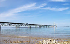
The currents of the Straits of Mackinac are known for their volatility; they have for millennia pushed the birch bark canoes of Native Americans and voyageurs alike off course and forced lake freighters aground.
The currents are also part of the complex lake system that links Lake Michigan to Lake Huron. Monitoring currents and waves in the Straits -- and throughout the Great Lakes -- is of great interest to scientists, municipal managers, the shipping industry, environmentalists and government agencies.

Inset photo: Lorelle Meadows and Guy Meadows received a grant from the Great Lakes Observing System (GLOS) to bring a pilot high-frequency radar project to Michigan. (Photo © Nathan Shaiyen and courtesy Michigan Tech University)
Great Lakes Geometry
High-frequency radar is a shore-based remote sensing system used to measure currents offshore by sending a low-power electromagnetic pulse over the water. The electromagnetic wave interacts with marine surface waves, which scatter the radar signal. By measuring the magnetic pulse bounces from marine waves back to the radar tower, researchers are able to map the speed and direction of the underlying currents. ... Click here to read the rest of this article and see a video about this research on the Michigan Tech News.


No comments:
Post a Comment