See our right-hand column for announcements and news briefs. Scroll down the right-hand column to access the Archives -- links to articles posted in the main column since 2007. See details about our site, including a way to comment, in the yellow text above the Archives.
Showing posts with label Michigan Dept. of Natural Resources. Show all posts

Saturday, July 18, 2020

DNR Director Eichinger asks Enbridge parent company to assume Line 5 financial obligation

LANSING -- On Friday, July 17, Michigan Department of Natural Resources (DNR) Director Dan Eichinger sent a letter to Enbridge Inc., requesting that the corporation enter into a written agreement with the State of Michigan to provide financial assurances to cover all damages and losses caused to property or individuals due to operation of the Line 5 dual pipelines through the Straits of Mackinac. Eichinger requested that Enbridge Inc. enter into a written agreement with the State of Michigan to provide sufficient financial assurances to cover any loss, including a catastrophic release from the dual pipelines.

"As recent events have reminded us, we must get these pipelines that transport crude oil out of the Great Lakes as soon as possible," said Eichinger. "In the meantime, Enbridge must provide full financial assurance to the people of Michigan that the company will meet its obligations in the event there is a spill or some other disastrous damage to the Great Lakes."

The 1953 Easement allowing placement of the Line 5 dual pipelines in the Straits of Mackinac requires Enbridge Energy Company Inc., the corporate successor to Lakehead Pipe Line Company, to compensate the State of Michigan for all damages and losses caused by the operation of the pipelines, and to provide insurance, bond or surety liability coverage.

Under former Gov. Rick Snyder, Enbridge signed an agreement to fulfill that requirement, but only signed as a subsidiary of Enbridge Inc. The subsidiary does not have sufficient resources to cover the costs of a spill. Additionally, in an expert report titled "An Analysis of The Enbridge Financial Assurances Offered to the State of Michigan On Matters Related To The Operation of the Enbridge Line 5 Pipeline At the Straits of Mackinac (Oct. 29, 2019)," American Risk Management Resources Network (ARMRN) concluded that Enbridge Inc. is not subject to the indemnity language under the 1953 Easement. To address this deficiency, in his letter to Enbridge, Eichinger requested an agreement that includes the following:
  • Enbridge Inc., the parent company, agrees to assume the indemnity obligations of Enbridge Energy Company, Inc. (successor to Lakehead Pipe Line Company).
  • Enbridge Inc. agrees to a minimum of $900 million in liability insurance.
  • Enbridge Inc. names the State of Michigan as an additional insured party on the identified policies so that Michigan’s right of recovery is not derivative.
  • Enbridge Inc. will directly pledge its own assets for the remainder of the financial assurance requirements (to meet or exceed $1.878 billion, annually adjusted for inflation).
On June 25, 2020, Ingham County Circuit Court Judge James S. Jamo granted Attorney General Dana Nessel’s motion for a temporary restraining order requiring Enbridge Energy to cease all transport operations of its Line 5 twin pipelines.*

Click here to see the July 17, 2020, letter from DNR Director Eichinger to Enbridge Inc.

*Editor's Note: See our June 25, 2020 article, "UPDATED: Judge orders Enbridge to cease Line 5 operations following recent damage."

Saturday, April 13, 2019

Weyerhaeuser Co. requests state metallic mineral lease in Marquette County

This map shows the parcels in Wells Township nominated for metallic mineral lease. Click on map for larger version. (Map courtesy Michigan Dept. of Natural Resources)

LANSING --Weyerhaeuser Company, of Seattle, Washington, has requested four direct metallic mineral leases from the State of Michigan covering Department of Natural Resources (DNR) metallic mineral rights located within Wells Township, Marquette County, containing a total of 1,476.46 acres, more or less. For a full description of the parcels requested for lease, please visit the Weyerhaeuser Company Public Notice.

The parcels are currently being reviewed by resource experts to determine the most appropriate level of surface use that should be allowed for development activities. To learn more about State of Michigan metallic minerals leasing, click here.

Written comments from interested parties, relative to the request to lease the specified minerals, may be submitted to DNR, Office of Minerals Management, P.O. Box 30452, Lansing, MI 48909 or DNR-Minerals@michigan.gov.  All comments must be received no later than May 10, 2019.

Click here for more information on mineral leasing and links to additional maps.

Saturday, December 22, 2018

Mackinac Straits Corridor Authority approves agreement to build multi-use tunnel, remove pipelines from bottom of Straits

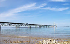
A view of the Mackinac Bridge, crossing the Straits of Mackinac. Enbridge's 65-year-old Line 5 pipeline, which lies under the Straits, is destined to be replaced by a multi-use utility tunnel, according to a Dec. 19, 2018, agreement between the State of Michigan and Enbridge. (Keweenaw Now file photo)

From: Michigan Department of Natural Resources (DNR) Bulletin

ST. IGNACE, Mich. -- The Mackinac Straits Corridor Authority (MSCA) approved on Dec. 19, 2018, an agreement with Enbridge Energy Limited Partnership to build a multi-use utility tunnel beneath the Straits of Mackinac. The tunnel will house a replacement segment for the Line 5 pipeline that sits on the bottom of the Straits and other utilities.

In addition, the authority, which held its inaugural meeting in St. Ignace, approved the transfer of a property right that will allow Enbridge to construct the tunnel in bedrock beneath the Straits.

Gov. Rick Snyder and leaders of the departments of Natural Resources and Environmental Quality signed a separate agreement with Enbridge on Dec. 19. This Third Agreement carries forward provisions of two previous agreements with the company -- one in November 2017 and one in October 2018. The Third Agreement requires Enbridge to undertake an enhanced inspection and stewardship regimen. The agreement also includes interpretations of the 1953 easement for the dual pipelines on the bottom of the Straits, as well as ongoing financial assurance requirements for the pipelines.

The Line 5 pipelines would be removed from the bottom of the Straits once the tunnel is complete. The construction could take 7-10 years.

Visit the Michigan Petroleum Pipelines Web site to download these Dec. 19 agreements.

Click here to read the rest of this bulletin from the Michigan DNR.

See also the Dec. 20, 2018, updated article on mlive.com: "Gov. Snyder finalizes Line 5 tunnel deal."

See the recent post from Enbridge here.

Friday, November 30, 2018

Environmental and human health threats from poorly regulated mining in Michigan's UP continue to multiply; DNR to hold meeting on Highland Copper's lease request Dec. 4

Click on map for slightly larger version showing mineral lease requests. (Map courtesy Steve Garske and Upper Peninsula Environmental Coalition)

[ANNOUNCEMENT: The Michigan Department of Natural Resources’ Office of Minerals Management will hold an informational public meeting on a metallic minerals lease request by UPX Minerals Inc., a division of Highland Copper, from 6 p.m. - 8 p.m. (ET) Tuesday, Dec. 4, in the Charcoal Room at the University Center on the campus of Northern Michigan University in Marquette. DNR officials will give a brief overview of the metallic mineral lease request submitted by UPX Minerals, Inc., and will provide the audience with the opportunity to ask questions. Questions will be answered as time allows. The following article, by Steve Garske, is a slightly updated version of his article that appeared recently in UP Environment, the Fall 2018 newsletter of the Upper Peninsula Environmental Coalition (UPEC). It is published here with permission.]

By Steve Garske*

On May 30, 2017, Highland Copper Company Inc. acquired approximately 447,842 acres (700 square miles) of mineral properties in the central UP (the "UPX Properties") from the Rio Tinto Group. Then this spring Highland/UPX Minerals requested some 3900 acres (over 6.1 square miles) of mineral leases from the state.

Unlike previous lease requests, which targeted primarily state and commercial forest lands, these potential leases include a state natural area (Rocking Chair Lakes), the Noquemanon Trail Network in the Forestville Trailhead area, and the Upper Peninsula Land Conservancy's Vielmetti-Peters Conservation Reserve near Marquette. They also include lakes, wetlands, streams and rivers, camps, homesteads and residential areas. Affected landowners are understandably upset with the possibility of mineral exploration under their lands and even their homes.

Highland's lease request follows on the heels of the Michigan DNR's handing mineral leases for 15,300 acres (23.9 square miles) of mostly public and private forest land in Baraga, Houghton, Iron and Marquette Counties to Eagle Mine/Lundin LLC in 2017. Soon afterwards, Lundin requested a lease for state mineral rights under Haystack Mountain in Houghton County, which the state gladly handed them earlier this year. Haystack Mountain is a unique geologic feature, an ancient 100-foot high "volcanic plug" that straddles Ottawa National Forest and private land.

Except for Highland's lease request, which is still "under consideration," the Michigan DNR has handed over leases to every square inch of mineral rights that mining companies have requested. Why? It certainly can't be the state royalties. As stated by the state's Metallic Minerals Lease Agreement, "Rental for the first (1st) through fifth (5th) year shall be paid at the rate of $3.00 per acre per lease year, and for the sixth (6th) through tenth (10th) year at the rate of $6.00 per acre per lease year." Lease royalties don't kick in until the 11th year, when rates go to $10.00/acre and up. (See https://www.michigan.gov/documents/dnr/PR4340MetallicMineralLease_197342_7.pdf)

Topping off the state's willingness to please the mining industry was the decision by DEQ director Heidi Grether to overrule her professional staff and hand Aquila Resources Inc. a wetland destruction permit for their "Back 40" mine, even though the company's application failed to meet the requirements of state and federal law.

Sixty Islands section of the Menominee River, riparian wetlands located approximately 200 feet from the proposed Project Boundary of the Aquila Back Forty Mine site. (Jan. 9, 2018, photo by Kathleen Heideman, UPEC's Mining Action Group.)

The willingness of the DNR and DEQ to freely hand out exploration and mining permits can be blamed in large part on a phenomenon known as "regulatory capture." Wikipedia (2018) defines regulatory capture as "... a form of government failure which occurs when a regulatory agency, created to act in the public interest, instead advances the commercial or political concerns of special interest groups that dominate the industry or sector it is charged with regulating." A University of Chicago School of Business blogger defines it as "...the tendency of regulators, politicians, and bureaucrats to cater to the interests of special interest groups that are highly informed and not to the interests of the general public" (Rolnik 2017). Regulatory capture can also occur when industry is the only source of technical expertise needed to understand production processes and what might go wrong (Cohen 2018).

Cohen goes on to describe a new form of regulatory capture: the willful rejection of science in setting environmental policy. This form of regulatory capture is based on fantasy and a disregard for expertise. In June Governor Snyder institutionalized regulatory capture in Michigan by passing the "Fox in the Henhouse" bills (Senate Bills 662-654), which let the governor appoint a panel of mostly industry representatives with the power to veto regulations written by the DEQ's environmental and health professionals.

The wild U.P. that many of us know and love is under threat like never before. The government agencies that are supposed to protect it are in large part working for the industries they are supposed to be regulating. It's going to be up to the rest of us to save the wild U.P.

Sources:

Wikipedia. 2018. "Regulatory capture." https://en.wikipedia.org/wiki/Regulatory_capture.

Rolnik, Guy. April 17, 2017. "When We Are Less Interested in the Truth, Capture Thrives." ProMarket: the blog of the Stigler Center at the University of Chicago Booth School of Business. https://promarket.org/less-interested-truth-capture-thrives/.

Cohen, Steve. April 16, 2018. "Scott Pruitt, Andrew Wheeler, and regulatory capture at the EPA." https://blogs.ei.columbia.edu/2018/04/16/pruitt-wheeler-regulatory-capture-epa/.

Editor's Notes:

* Guest author Steve Garske is a botanist and a member of UPEC's Mining Action Group.

** Click here to see detailed maps of the mineral lease requests.

*** See our Feb. 2, 2018, article, "DEQ hearing on Back 40 wetlands permit attracts nearly 500; Menominee Tribe lawsuit seeks federal Clean Water Act jurisdiction."

Monday, February 12, 2018

Updated: Copperwood Resources to resume winter copper exploration at Porcupine Mountains Wilderness State Park; settlement reached with DEQ on 2017 erosion damage

This photo taken in the winter of 2017 shows Gypsy Creek downstream, east of one of Copperwood Resources' 2017 drill sites inside Porcupine Mountains Wilderness State Park. When snow melted last spring, erosion into a wetland and ditch leading to a tributary to Gypsy Creek led to the work being halted in April. Copperwood is now resuming exploratory drilling in the park. (File photo © and courtesy Steve Garske) 

The Michigan Department of Natural Resources (DNR) reported on Feb. 6, 2018, that it has issued a use permit to Copperwood Resources Inc. -- a subsidiary of Highland Copper -- to resume its winter exploration of a 1-mile section of the westernmost portion of Porcupine Mountains Wilderness State Park.

Work is being done in this part of Gogebic County to see if the eastern extension of a mineral deposit first explored in the 1950s might feasibly be mined, which would enlarge the mining company’s Copperwood Project beyond its currently permitted boundaries.

This map shows the location of test holes planned for exploration this winter. Click on map for larger version. (Map courtesy Michigan Department of Natural Resources)

Drilling and testing will determine hydrologic and geologic composition of the bedrock beneath the surface. Work on these sites is scheduled to be completed over the next month and a half.

"This use permit will allow Copperwood Resources to resume work begun last winter at the park," said Doug Rich, western U.P. district supervisor for the DNR’s Parks and Recreation Division. "However, this winter’s exploration will be scaled back from the mining company’s original plans."

Copperwood, Michigan DEQ reach settlement on April 2017 erosion damage

In January 2018 the DNR, the Michigan Department of Environmental Quality (DEQ) and the Gogebic County Road Commission reported that the DEQ and Copperwood Resources had reached a settlement addressing work-related erosion which occurred during spring break-up in April 2017, along Gogebic County Road 519 at Porcupine Mountains Wilderness State Park.

Carlos Bertoni and Tom Repaal of Highland Copper discuss remediation efforts in August 2017. (Photo courtesy Michigan DNR)

Representatives from the DEQ and Copperwood Resources recently signed an administrative consent order, a legal settlement addressing damages without conveying admissions of violations of law, which included a $25,000 fine.

Since March 17, 2017, work had been ongoing within a 466-foot road right-of-way (233 feet on each side of the road) owned by the Gogebic County Road Commission. Work was halted April 4 after Highland Copper officials were informed of several potential erosion issues on the county property. A contract drilling company was part way into drilling their last scheduled test core hole.

Steve Casey, U.P. district coordinator for the DEQ’s Water Resources Division in Marquette, said the mining company continued test drilling operations during spring snowmelt, in and around wetlands, without first obtaining the necessary wetlands or soil erosion and sediment control permits. The resulting work damaged wetlands and resulted in a discharge of muddied water from the site.

Highland Copper maintained they didn’t anticipate the spring warm-up and didn’t know that much of the land was wetland until they received a report from their consultant, King and McGregor. This April 2, 2017, photo shows how their contractor had turned a half mile of snowmobile trail into a muddy mess. (Photo courtesy Mining Action Group)

"They made the unfortunate decision to continue drilling during snowmelt last spring, resulting in rutting in wetlands and soil erosion from their drilling site," Casey said. "Once this mistake became evident, they have been models of cooperation, restoring the relatively minor damage to wetlands and stabilizing the site against further erosion."

Had the ground been frozen and snow covered during these activities, likely there would have been no erosion or wetland disturbance and no need for wetlands and soil erosion permits, Casey explained.

Members of the Upper Peninsula Environmental Coalition’s (UPEC's) Mining Action Group (MAG) -- a watchdog group monitoring mining activities in the region -- alerted the DEQ and the media to the erosion. MAG’s alarming photographs of the damage (see above) were quickly picked up by the media, and brought to the attention of the Michigan DEQ. The DEQ promptly sent staff from the Marquette office to the site on Tuesday, April 4, 2017. The company was required to suspend work that day, and soon after were issued a Violation Notice by the DEQ.*

UPDATED: The company was cited for allowing muddy runoff to reach Gypsy Creek, on the southern end of drilling site. However, much of the mud flowed north along the ditch and down the wide ravine of the Presque Isle River, where it was deposited on the floodplain of the river, within the Park (north of the drilling site), as pictured here in September 2017. (Note: We have corrected this caption, which previously identified this as a photo of Gypsy Creek. It is the floodplain of the Presque Isle River.) (Photo courtesy Mining Action Group)

Given the incident, members of the coalition said they have deep concerns about the Copperwood Project.

"Their Copperwood mine project sits on the shore of Lake Superior, and now they are taking steps towards mining under the west end of the Porkies as well, so the stakes are extremely high," Steve Garske, a UPEC board member said.

Carlos Bertoni, vice-president of exploration at Highland Copper, said the mining company is moving forward, with an assessment of the feasibility of the Copperwood Project anticipated this summer.

"Our team has learned a great deal from this incident and future work will continue to be done under strict compliance with current environmental legislation and best practices," Bertoni said. "We remain committed to developing the Copperwood Project, thus creating new economic opportunities for the western Upper Peninsula."

In April 2017, the DEQ issued an order requiring the mining company to stabilize the site and restore the wetlands.**

Copperwood Resources employed Coleman Engineering Co., an Upper Peninsula firm, and Michigan wetland specialists King and MacGregor Environmental, to work on getting short- and long-term erosion control measures in place. That work continued throughout the summer.

This Aug. 8, 2017, photo shows a catch basin in between Gogebic County Road 519 and an old snowmobile trail, where springtime erosion had occurred. The basin is intended to block water and silt from entering a nearby tributary to Gypsy Creek. With remediation efforts complete, the biodegradable holding structures were removed. This photo shows the site from the snowmobile trail, looking toward County Road 519. (Photo courtesy Michigan DNR)

"Going into winter, the site was stable. An area of the snowmobile trail near the northern boundary of the drilling area was graded to remove ruts, after it dried out in late summer," Casey said. "Vegetation in that area is not as thick as it is over the rest of the site. It will be monitored by Copperwood Resources, the DEQ and Gogebic County going forward."

Copperwood to resume exploration with three test holes in park

The mining company is expected to drill three test holes (S5-05b, S5-06 and S5-09) on DNR-managed state park land west of Gogebic County Road 519 (Section 5, T49N R45W, Wakefield Township, Gogebic County).

DEQ's Steve Casey said recently that Highland Copper has applied for a wetlands permit for work related to the exploratory drilling in the state park.

"DEQ staff is processing the application and will monitor all aspects of compliance with environmental laws if this project proceeds, including working with Gogebic County to ensure that appropriate measures are taken to control soil erosion," Casey said.

UPDATE: This map accompanies Copperwood Resources' wetland permit application. It shows Section 5 sites for 2018 winter drilling and wetland impacts. The yellow line is the state park boundary, indicating DNR surface rights. Click on map for larger version. (Map courtesy Michigan DEQ)

The three drill sites were among 12 expected to be explored last winter when work was interrupted by warm weather after only four were completed.

DNR permit provisions to protect park surface features dictated work could only be done when the ground was frozen, preferably with at least a foot of snow cover.

"Conditions of the DNR use permit will again require several important provisions be followed to prevent or reduce surface disturbance to park lands," said John Pepin, DNR deputy public information officer. "This exploration effort will not be occurring in the wilderness section of the park, but in an area where several historic impacts have occurred, including logging and a narrow-gauge railroad."

Other protective provisions include using existing roads to access sites when possible, using tracked vehicles and removing all drilling mud from work sites. The DNR will receive daily updates on the project.

Once the three sites are completed within the park, Copperwood Resources does not plan to drill the remaining five sites from its initial Section 5 exploration plan.

Additional activity outside park lands

Outside DNR-managed park lands, some additional drilling work is scheduled to be completed this winter.

Two test holes (18_03 and 18_10) will be drilled from Copperwood Resources lands located west of the park, along the border of Section 5.

The Gogebic County Road Commission recently issued a permit to allow Copperwood Resources to finish work at three sites (18_11, 18_12 and S5-13) begun last winter.

A drilling rig arrives and is set up at Porcupine Mountains Wilderness State Park in February 2017. (Photo courtesy Copperwood Resources, Inc.)

This exploration is occurring within a strip of road commission property -- a 466-foot right-of-way -- along either side of Gogebic County Road 519, which bisects Section 5.

"This winter, we will be reaching sites directly from County Road 519 to help protect sensitive areas," said Justin van der Toorn, exploration manager of Copperwood Resources Inc. "We are taking other measures, including drilling smaller diameter test holes, that will speed the exploration process."

Boring depths will range from roughly 150 feet to 1,000 feet below the surface. Test holes are immediately filled with cement once drilling cores are removed.

Darren Pionk, Gogebic County Road Commission engineer-manager, said the agency will not allow the drilling of any holes in the right-of-way without frozen ground or near the spring thaw period.

The road commission permit also requires all work, and access to sites, be conducted in upland areas with no impacts to wetlands.

Future Efforts

If Copperwood Resources eventually decides to extend the Copperwood Project, the copper deposit would be accessed from outside the park boundary, without disturbance to park surface features.

Any potential mining of the minerals would require a separate regulatory process through the DEQ. Copperwood Resources would have to amend its existing permit.

"The DNR will ensure there would be opportunity for public review and comment before any mining would occur on minerals beneath the park," Pepin said.

The mining company plans to complete its feasibility study of the project later this year.***

Editor's Notes:

* See the Mining Action Group's Sept. 8, 2017, article, "Setting the Record Straight on Highland’s Drilling in the Porkies." Note: We have corrected the caption
** See our April 7, 2017, article, "State, county officials address citizens' concerns about erosion from Highland Copper mining exploration along CR 519 in Porkies."

*** For more information on the Copperwood Project visit https://www.highlandcopper.com/copperwood

Thursday, August 03, 2017

DNR to host public meeting Aug. 3 on proposed stamp sands dredging work in Houghton County

A U.S. Army Corps of Engineers map shows the stamp sands area in Houghton County. Click on map for larger version. (Photo © Charles Kerfoot and courtesy Michigan Department of Natural Resources)

LAKE LINDEN -- The Michigan Department of Natural Resources (DNR) will host a meeting to tell the public about a proposed dredging project designed to restore the Grand Traverse Harbor channel and help protect Buffalo Reef.

The meeting will be at 6 p.m. TONIGHT, Thursday, Aug. 3, at the Lake Linden-Hubbell High School Auditorium, 601 Calumet Street in Lake Linden.

Public input from this meeting will be considered before the project application is finalized.

Representatives of several agencies cooperating with the DNR on the proposed project will attend the session, including the U.S. Army Corps of Engineers, the U.S. Environmental Protection Agency and the Michigan Department of Environmental Quality.

Tailings, or waste rock from mining, known locally as "stamp sands," were dumped into Lake Superior near the community of Gay, more than 100 years ago. These sands have moved, with the action of the lake, about 5 miles south along the coast and in nearshore areas.

In this image, the dashed line shows the area of stamp sand near the stack in Gay (upper right) has diminished since 1938 as that toward Big Traverse has grown. Number 1 marks primary stamp sands on the shore near the location of the former mill at Gay, and number 2 marks secondary stamp sand that is carried by the current and redeposited on the shore southwest of Gay and in the lake. Click on image for larger version. (File photo courtesy Keweenaw Geoheritage Web site and Bill Rose. Reprinted with permission.)*

The stamps sands are now filling in Grand Traverse Harbor and threaten Buffalo Reef, an important spawning area for lake trout and whitefish.

The DNR is applying for a permit from the DEQ, under the Great Lakes Submerged Lands Act, to allow the Army Corps to remove some of the stamp sands from the lake. Doing this will reestablish the Grand Traverse Harbor channel and provide 5-7 years of protection for Buffalo Reef.

The EPA has provided funding for the Army Corps to design and carry out the dredging work to remove 205,000 cubic yards of stamp sand—about 35,000 cubic yards from in or near the harbor and 170,000 cubic yards to protect Buffalo Reef.

Over the next couple of years, a task force will be convened by the EPA to develop a long-term plan for protecting the harbor and reef.

The project is proposed to take place in Schoolcraft Township in Houghton County. Some of the placement of the stamp sands removed from the lake is tentatively planned for Sherman Township in Keweenaw County.

* Learn more about the Gay stamp sands on Bill Rose's Geoheritage Web site, which also has links to scholarly articles on the stamp sand, photos and more. See also our Nov. 17, 2014, article, "Geology expert notes concerns about arsenic in Gay stamp sands as DEQ accepts comments on stamp sand removal proposal."

Tuesday, November 24, 2015

DNR offers reward in Houghton County wolf poaching case

DNR press release dated Nov. 23, 2015:

MARQUETTE -- The Michigan Department of Natural Resources is offering a Report All Poaching (RAP) reward for information leading to the arrest and conviction of the individual who shot a gray wolf in Houghton County Saturday, Nov. 21.

The shooting took place along M-26, one half-mile south of Twin Lakes.

DNR conservation officers said the shooter’s vehicle would have been parked along the west shoulder of M-26, heading southwest. The shooting took place sometime between the hours of 10 a.m. and 1:30 p.m. EST.

"The subject shot from the vehicle and struck the wolf as it was standing on the snowmobile trail (Trail No. 3) to the west of the highway," said Sgt. Grant Emery of the DNR’s Baraga Field Office.

Gray wolves are a federally endangered species and are protected in Michigan. Wolves cannot legally be killed except in the defense of human life.

The maximum penalty for poaching a wolf is 90 days in jail or a fine of up to $1,000, or both, plus reimbursement of $1,500 to the state for the animal. Poaching convictions also usually include a suspension of hunting privileges for a period of four years.

Anyone with information about this case is asked to call the Marquette DNR District Office at 906-228-6561 or the Report All Poaching line at 1-800-292-7800. All information provided is confidential.

For more information about gray wolves in Michigan, visit the DNR’s webpage at: www.michigan.gov/wolves.

Tuesday, October 13, 2015

Letter to DNR: Save the Wild U.P. requests moratorium on mineral leasing, public hearing on 320-acre lease request from North American Nickel

This Andersen archaeological site, damaged during recent resource extraction activities, is located within the 320 acres of public land, in section 35, Michigamme Township, where North American Nickel has requested a metallic mineral lease. (Photo courtesy Save the Wild U.P.)
 
[Editor's Note: Save the Wild U.P. (SWUP) recently sent a letter to the Michigan Dept. of Natural Resources (DNR) with their comments on North American Nickel's request for a metallic mineral lease on 320 acres of public land in Section 35 of Michigamme Township, Marquette County, Michigan. We are publishing part of their letter here at SWUP's request.]

Karen Maidlow, MAIDLOWK@michigan.gov
Property Analyst, Minerals Management
Department of Natural Resources
P.O. Box 30452
Lansing, MI 48909
October 12, 2015

Dear Ms. Maidlow,

On behalf of Save the Wild U.P.’s Board of Directors, Advisory Board members, and SWUP’s supporters, we strongly urge the Department of Natural Resources (DNR) to deny the mineral lease sought by North American Nickel, Inc. for 320 acres of State-owned land on the Yellow Dog Plains (SW1/4; N1/2 SE1/4; W1/2 NW1/4, Section 35, T51N, R29W, Michigamme Township, Marquette County).

We ask the DNR to deny this mineral lease for the following reasons:

Ecological Concerns

Ecologically, this land is part of the Escanaba River State Forest, and supports a jack pine forest habitat, including age/class critical to the endangered Kirtland’s warbler. The DNR lease review acknowledges the possible (?) presence of this species. Does the lease review process involve any on-site review? Kirtland’s warblers have been seen in this area by local birdwatchers. We ask the DNR to conduct a rare species survey on the property before further ecological disruption is sanctioned, in collaboration with local experts and environmental stewards who are deeply familiar with the land. Moreover, we request that the DNR complete a landscape-scale habitat preservation plan for the Yellow Dog Plains, with an eye to Kirtland’s warbler conservation. The current Land Management Plan for the Yellow Dog Plains is out of date, and fails to address any of the industrial threats. The Yellow Dog Plains is seasonally used by migratory songbirds and waterfowl, which are unaddressed in the lease review.

Endangered Kirtland's Warbler. (Photo © and courtesy Joseph Youngman. Reprinted with permission.)

According to the DNR’s Management Plan for the Yellow Dog Plains, this area "provides multiple benefits including forest products, dispersed recreational activities, and provides habitat for a variety of fish and wildlife species" and the DNR's stated management priority in this area "is to continue to provide these multiple benefits..."

Note: Mineral exploration was NOT listed among the DNR’s management priorities for this land.

Archaeological Concerns

The DNR lease review acknowledges the presence of a site of "archaeological significance" on this land. While confirming the nature of this archaeological site (a homestead), it has come to our attention that this significant site has never actually been evaluated. There is a standing ruin on the property, but also a number of related sites on the property that would be difficult for a mineral exploration team to "see" much less avoid disturbing.

Historically, this land is an integral part of our collective culture. As historian Jon Saari has noted, "The Yellow Dog Plains is one of those storied places in our collective
imagination. That place, and the larger community we live in, includes rivers, forests, wildlife, rocks and waterfalls, and quiet backwoods camps."

Archaeologically, the site contains a remnant structure from the Andersen Homestead, directly connected to the land’s first European settlers, the result of the controversial Homestead Act. The Nels Andersen homestead (misspelled Anderson on some maps and sources), was built by early Danish immigrants who settled on the Yellow Dog Plains in 1902. Additionally, the history of the Andersen family and their homestead are interwoven with the history of White Deer Lake, as members of the Andersen family were employed by industrialist Cyrus McCormick -- land now preserved as the McCormick Wilderness Area. Photographs, oral histories and stories related to the Andersen site were recorded by the late historian and storyteller, C. Fred Rydholm, in Superior Heartland: A Backwoods History.

North American Nickel, Inc, is seeking a new mineral lease for 320 acres of Public Land (area in brown) on the Yellow Dog Plains. Grassroots environmental group Save the Wild U.P. is urging the Michigan DNR to reject the mineral lease application, stating that it threatens to undermine critical habitat for the Kirtland’s Warbler, and a site of historical significance. Click here for a larger version of the map. (Map courtesy Save the Wild U.P.)

Prior to the 1900’s, the plains were frequented via a trail between L’Anse and Big Bay, used for hunting and berry-picking, with a strong pre-European Indigenous presence. Much evidence of this ancient trail was obliterated in 2014, when the historic sand road was replaced with a highway (pavement ends at the gates of Eagle Mine, approximately 3 miles SE of this historic site).

Recently, the physical integrity of the Andersen historical site was severely damaged during the DNR’s logging of the public forest. The damage has not been remedied, and may have been undocumented. This fragile archaeological site will only be further compromised by new mineral exploration, and increased traffic on the 2-track roads that pass the ruins. This lease request (North American Nickel, Inc.) follows a mineral lease granted to Prime Meridian; it is clear that the Andersen archaeological site was damaged and the environment degraded during the tenure of that mineral lease -- without DNR intervention.

Save the Wild U.P. respectfully requests that a moratorium on mineral leasing be instituted until the integrity of all Andersen historical sites, and their archaeological significance, can be fully evaluated.

Indigenous Natural Resources

Contemporary tribal uses of this land include the gathering of traditional foods and medicines, in accordance with protected treaty rights. Given the long history of pre-European Indigenous presence, the Yellow Dog Plains have a cultural value -- beyond their ecological value, watershed, mineral or timber value -- deeper than the value of any individual archaeological site. This land should be seen as an integral part of the human culture and natural history of Marquette County, the Keweenaw Bay Indian Community, "the wild U.P." and the State of Michigan as a whole.

Hydrological Concerns

In their Management Plan for the Yellow Dog Plains unit, the DNR states that "almost all state lands are leased and extensive exploration has been conducted" yet notes "there is insufficient data to determine the glacial drift thickness" on the Yellow Dog Plains.

Clearly, the State of Michigan is allowing a live experiment -- industrialization of a remote and previously unpolluted environment -- to play out in real time, with insufficient monitoring and a pattern of "insufficient data."

If the DNR does not possess sufficient data about the thickness of glacial sand deposits in this area, they must also lack sufficient understanding of the complex hydrogeology of the Yellow Dog Plains, especially the groundwater aquifer contained in these glacial sands, an aquifer which is currently pristine and without industrial contamination.

Groundwater from the NW Yellow Dog Plains aquifer feeds the headwaters of several rivers and coldwater trout streams, such as Cedar Creek, Salmon Trout River, Yellow Dog River -- and unique spring-fed ponds, including nearby Andersen Lake, which provide key habitat for mammals (especially predators crossing the Yellow Dog Plains), migratory birds, reptiles, amphibians, insects and native plants, including threatened species.

No watershed information is included in this mineral lease application, but we assume that surface water (precipitation) on this parcel drains into headwaters of Cedar Creek, flowing into Mountain Lake en route to Lake Superior. Mountain Lake is a pristine wilderness lake of critical scientific research value, located entirely within the Huron Mountain Club. Groundwater in this parcel, by contrast, feeds the Salmon Trout River. Mineral exploration poses serious and apparently unconsidered risks to groundwater. We ask that the DNR explain how mineral exploration is regulated with regards to drilling in this unconfined sand aquifer, given the "insufficient data" about the land’s hydrogeology, and lack of oversight in the field.

Note: if the DNR is truly interested in hearing the public comments about mineral leasing of State lands on the Yellow Dog Plains and elsewhere, we believe the ideal venue for this exchange of information would be a Public Hearing -- something which Save the Wild U.P. has repeatedly requested....Click here to read the rest of this letter.

Monday, October 12, 2015

Letter to DNR: Moratorium on Upper Peninsula mineral leases needed to protect watersheds, land use imbalance

[Editor's Note: Today, Oct. 12, is the deadline for public comments on North American Nickel's request for a metallic mineral lease from the State of Michigan on 320 acres of public land in Section 35 of Michigamme Township, Marquette County, Michigan. Gene Champagne of Concerned Citizens of Big Bay submitted the following letter to the DNR and has shared it with Keweenaw Now. The following is reprinted here with permission.]*

Karen Maidlow
Property Analyst, Minerals Management
Department of Natural Resources
P.O. Box 30452
Lansing, MI 48909

Dear Ms. Maidlow:
I am writing these public comments urging you and the MDNR to reject the mineral lease for North American Nickel for a 320 acre state owned parcel in northwest Marquette County. The main reason for rejection by the MDNR is the sensitivity of the location with regards to wetlands and watersheds. The area is also rich in historical and cultural history for this area of Marquette County and the State of Michigan.

In addition to aforementioned reasons, all mineral lease requirements and criteria for metallic minerals in the Upper Peninsula need to reexamined and rewritten. When the current criteria were written, the specter of a new mining region and possible boom did not exist. The potential accumulated impacts of such a region by this segment of the mining industry places this entire region at serious risk for watershed decimation and land use fragmentation.

These mineral leases within the area known as the Yellow Dog Plains are going to continue indefinitely as speculators crowd in regardless of proof of mineralization. If a mineral lease is granted and product is found, a permit will be issued regardless of risk involved. The DEQ will only make an attempt to minimize the risk as much as economically feasible to the lessee, not the interests of the other stakeholders (public) involved and affected.

Until the current system of granting mineral leases particular to this area of the state is reexamined and rewritten with a critical eye to both process and effects to non-leased lands and non-mineral extraction interests, there needs to be a moratorium on mineral leases. The minerals are not going anywhere. They will wait. To not correct the significant imbalance of negative effects caused to other lands and stakeholders outside the leased areas will lead to a totally out of balanced land use opportunity situation in this region that may never again be realized. Please deny this request for a mineral lease.

In addition, I respectfully ask that you pass on the above request for a moratorium to the proper agency personnel.

Thank you,

Gene Champagne                                                      
Big Bay, MI 49808

* Editor's Note: To learn more about this issue see our Oct. 6, 2015, article, "Nickel company seeks 320-acre metallic mineral lease on state land near Eagle Mine; comment deadline is Oct. 12."

Thursday, September 24, 2015

Guest article: Letter to DNR on Eagle Mine's proposed mineral lease near headwaters of Yellow Dog River

By Gene Champagne*

[Editor's Note: This letter was sent to the Dept. of Natural Resources as a comment on Eagle Mine's request for a metallic mineral lease from the State of Michigan for 40 acres of public land (NE 1/4 of the NE 1/4 of Section 8, T50N, R29W, Michigamme Township, Marquette County) in the Escanaba River State Forest. The deadline for public comments is Friday, Sept. 25, 2015.** The letter is reprinted here with the author's permission.]

Karen Maidlow
Property Analyst, Minerals Management
Department of Natural Resources
P.O. Box 30452
Lansing, MI 48909

September 23, 2015

Dear Ms. Maidlow:
I strongly urge you to deny the proposed mineral lease sought by Eagle Mine LLC for 40 acres of State-owned land (NE 1/4 of the NE1/4 of Section 8, T50N, R29W, Michigamme Township, Marquette County). Short of outright rejection of this mineral lease, I request a Public Hearing in this matter. I understand from the form letters you send out in such matters that Public Hearings are not routinely called for or done.

The DNR, as well as the DEQ, need to realize that these issues surrounding mineral leases and mining permits, in this part of the UP with this type of mineral exploration, cannot be conducted as business as usual. The issues at hand will impact an area that has historically, socially, and culturally been one of sustainability containing a wide range of public uses that will be negatively impacted far into the future just by the mere presence of exploration and mining. I understand that mineral leases in themselves do not guarantee that a mining operation will follow. I also understand that a mining permit application may not, in theory, automatically be granted. The reality however is that if minerals are economically feasible for extraction, a mining permit no matter how flawed and risky will be granted. Over-weighted and unduly influential political and financial interests will join until extraction becomes a done deal.

The parcel in question is located in an intact watershed and contains an undisturbed headwater wetland ecosystem of over 1,000 acres. Wetlands have been greatly depleted in our state due to fragmentation of land areas with negative consequences for long-term sustainability. Andersen Creek, identified as headwaters of the Yellow Dog River, flows through this land. The Yellow Dog River has been designated as a Scenic and Wild River.

This 40 acre parcel may be the only piece of land that the DNR is required to look at, but the negative impacts of  a mineral lease permit to surrounding  parcels is so overly intrusive as to negate the enjoyment and usefulness of the multi-faceted activities enjoyed by a broader range of the general public.

These lands are used for gathering blueberries (of which there are an abundance on this 40 acres being scrutinized), hiking, biking, camping, mental recreation that comes from solitude, and many other uses that benefit a far larger public. This 40 acre parcel lies west of the current Eagle Mine operation and thus is given relief from the noise, truck traffic, light pollution, and other incursions that have interrupted and interfered with the quality of life enjoyed by area residents, camp owners, and tourists alike. The public should not suffer further erosion of enjoyable activities on state (public) owned land for the benefit of such a few.

I have personally set foot on this 40 acre parcel. It is a place of immense beauty and solitude. I have found moss there so thick that sitting on the ground rivals the comfort experienced from sitting on the deepest most comfortable couch available. As mentioned, blueberries are in abundance. Walking along one feels as if walking on a sponge, as the area is that wet; this despite the area being 4.5 inches below average for precipitation so far this year. The southern half of the 40 acres is wet/swamp land. No drilling can be performed on these 40 acres without negatively impacting and degrading the watershed to some degree. I have witnessed the impact of exploratory drilling in the area and the weak to nonexistent oversights that accompany it.

Holding a Public Hearing on this permit request will allow the DNR to witness firsthand the passion that people of this state, and particularly the people who live closest to the affected land, have for the quality of life activities afforded by our land. Fragmentation of land and land use is what has led to the scourge of urban sprawl and diminishing of wetlands that accompanied it. This situation of allowing such an overbearing effect of other area land and activity use through fragmentation will amount to the same negative future for our children and grandchildren.

Respectfully Submitted,
Gene Champagne
Big Bay, Michigan

Editor's Notes:

* Guest author Gene Champagne is a spokesperson for Concerned Citizens of Big Bay.

** See our Sept. 21, 2015, article, "Environmental, conservation groups question Eagle Mine's request to lease 40 acres of state land near Yellow Dog River headwaters."

Wednesday, August 05, 2015

Two Keweenaw state parks picked for best campground in Lake Superior Magazine’s 2015 ‘Best of the Lake’ readers' poll

From Michigan Department of Natural Resources

Cover of September 2015 issue of Lake Superior Magazine. (Image courtesy Michigan Department of Natural Resources)

MARQUETTE -- Fort Wilkins Historic State Park, located just west of Copper Harbor in Keweenaw County, and F.J. McLain State Park near Hancock in Houghton County, recently were voted first- and second-place winners, respectively, for Michigan shore "best campground" by the readers of Lake Superior Magazine.*

More than 650 print magazine readers, website followers and fans of establishments around the Lake Superior shoreline voted in the poll. The results, which included 101 total winners, were published in the September 2015 issue of the magazine, which is now on sale.

"We are very proud of our park and our efforts at customer service," said Bonnie Harrer, Michigan Department of Natural Resources' office support at Fort Wilkins Historic State Park.

Kids and parents enjoy a warm Saturday afternoon at the playground at Fort Wilkins Historic State Park. (Photos courtesy Michigan Dept. of Natural Resources unless otherwise indicated)

Fort Wilkins supervisor Wayne Burnett agreed, crediting the efforts of park employees and others to make Fort Wilkins a popular U.P. destination.

"Our people here do a tremendous job," Burnett said.

Winners were determined in several categories ranging from best weekend destination, beach and pizza to best park, burger and gift shop. Winners were named in each of the categories for Lake Superior’s four shores in Michigan, Wisconsin, Minnesota and Ontario, Canada.

"The 'Best of the Lake' has been around in some form or another since 1989," said Konnie LeMay, Lake Superior Magazine editor, in Duluth, Minnesota. "It started as '10 Best Lake Experiences.' Our formal 'Best of the Lake' list, voted on by readers, was first published in 1994."

LeMay said the magazine does not feature the same categories every year and it has been a while since they’ve included campgrounds.

This year, the campgrounds at Fort Wilkins took the No. 1 spot for the first time since the contest began. F.J. McLain State Park won a first-place award for "best park" in 2012. This year’s best park honor went to Pictured Rocks National Lakeshore and runner-up was Isle Royale National Park, whose gateway community is Copper Harbor.

A view of Lake Superior and Copper Harbor, which was honored as "best weekend destination" in Lake Superior Magazine’s "Best of the Lake" readers' poll this year. Fort Wilkins is just a short drive from Copper Harbor, and Isle Royale National Park can be reached by boat from either Copper Harbor or Houghton, Mich.

"We are very fortunate to have the support of the Fort Wilkins Natural History Association that funds the activities at the fort," Harrer said. "But it is our hardworking, fort-loving workers that make the visit for our customers comfortable and a wonderful experience."

This year, Fort Wilkins offered 45 evening programs, a new record. Park staff is proud of its service to the public and how many people volunteered to organize and staff the evening programs.

"All these things add up to why we feel we can brag about our beautiful and very vibrant park and we are thankful that the people who read Lake Superior Magazine voted us No. 1 in the 'Best of the Lake' contest," Harrer said.

A visitor takes a leisurely stroll with his dog through the east campground at Fort Wilkins Historic State Park.

Fort Wilkins Historic State Park is situated on 698 acres along the shores of Lake Fanny Hooe, a short distance across U.S. 41 from Lake Superior. The park has an east and west campground with a total of 159 campsites, a mini-cabin, a camper-cabin and a group-use area with four rustic sites.

Fort Wilkins was built in 1844 and today remains a well-preserved example of Army life during the mid-19th century. The site includes 24 buildings, half of which are original structures. The Copper Harbor Lighthouse, built in 1866, also is part of the park.

F.J. McLain State Park is located on 443 acres – between Hancock and Calumet – and has 90 campsites and cabins with electricity and without. The park is named for former Houghton County Road Commission Chairman Fredrick J. McLain who worked to have the property designated as a state park in the early 1800s.

"McLain State Park is honored to be voted as one of the best campgrounds on the lake in Lake Superior Magazine," said McLain State Park unit supervisor Jamie Metheringham. "The park is well-known to its visitors to have a superior sunset and spectacular view of the great lake."

Campers who have visited F.J. McLain State Park for many years enjoy a July day reading and relaxing at the park. The park welcomes campers with tents or recreational vehicles and includes a public beach just a short bike ride or walk from the campground. 

Overall, the Keweenaw Peninsula fared very well in this year’s Michigan contest voting by Lake Superior Magazine readers.

Additional first-place Copper Country nods included Copper Harbor as the "best weekend destination," the vista at Brockway Mountain as the "best scenic overlook," Fitzgerald’s Restaurant (Eagle River Inn) in Eagle River was voted the "best restaurant," with the Harbor Haus in Copper Harbor voted runner-up while the Michigan House Café and Red Jacket Brewing Co. in Calumet hit the top spot for "best burger."
An interpretive sign at a lookout point along Brockway Mountain Drive.

For more information on Michigan state parks, visit www.michigan.gov/stateparks. To check camping availability and make reservations, visit www.midnrreservations.com/. For more information on Lake Superior Magazine, visit www.LakeSuperior.com.

The Michigan Department of Natural Resources is committed to the conservation, protection, management, use and enjoyment of the state’s natural and cultural resources for current and future generations. For more information, go to www.michigan.gov/dnr.

* Click here to learn more about Fort Wilkins Historic State Park. See a map of F. J. McLain State Park here.

Saturday, August 01, 2015

DNR, township firefighters work to contain "County Road 601" wildfire in Humboldt Township

From Michigan Department of Natural Resources
Photos from Michigan DNR and Joe Derocha

Some of the roughly 80 acres burned by the Marquette "County Road 601" fire in Humboldt Township Thursday, July 30, and Friday, July 31. (Photos courtesy Michigan Department of Natural Resources unless otherwise indicated)

[Editor's Note: Scroll to the end of this article to see more photos -- taken Saturday, Aug. 1, 2015]

UPDATED: HUMBOLDT TOWNSHIP -- Michigan Department of Natural Resources (DNR) firefighters and crews from four township volunteer fire departments have been battling a roughly 80-acre wildfire in Humboldt Township, Marquette County, which was first reported Thursday afternoon, July 30. The fire was reported as 95 percent contained on Friday afternoon, July 31, and now, Saturday, is 100 percent contained within the fire line according to the DNR.

"They're working anywhere from 50 to 100 ft. in from the fire line toward the center of the fire area," John Pepin, DNR deputy public information officer in Marquette, told Keweenaw Now on Saturday, Aug. 1.

This map shows the area of the wildfire in Humboldt Township. The red dotted area to the southeast is the fire's containment line. Click on map for larger version. (Map courtesy Michigan Department of Natural Resources)

Starting from the edge of the containment line that now completely encircles the fire area, firefighters use foam and water to put out the fire, Pepin explained.

As of Saturday afternoon, no new hot spots had been found outside the fire line. Some of the remaining remnants of the log piles, still hot, were being busted up Saturday.

Crews from the DNR and Wisconsin firefighters from Mellen and Waupaca remained on the scene Saturday and the Humboldt Township Fire Department continued to shuttle water.

Humboldt firefighters set up additional portable drop tanks to supply water to DNR fire equipment. Pictured here, from left, are William Derocha, Humboldt Township cadet firefighter; Craig Thompson, Humboldt firefighter; and Zack Quale, Humboldt communications director. (Photo © and courtesy Joe Derocha)

Firefighters continued to get water for the fire from the Humboldt Mill, which is located not far from the fire area.

Firefighters' American flag is planted to show their progress as they move toward the center of the fire area from the fire line in their mopping up operation to extinguish remaining hot spots. (Photo © and courtesy Joe Derocha)

"They are making progress, but ground fire takes a lot of effort to put out and 80 acres is a large area," said Celeste Chingwa, DNR Upper Peninsula fire protection manager in Marquette. "This fire may burn in fuel pockets below the surface if conditions don’t change, so it will need constant monitoring."

At 4:27 p.m. Friday, July 31, the DNR released these details on the "County Road 601" wildfire in Humboldt Township:

GPS measurements determined the fire burned a total of approximately 80 acres with no further growth expected. A soil barrier has been created nearly all the way around the fire perimeter using DNR fire equipment. Low ground conditions prevent the remaining line from being constructed and a foam and water barrier is being used.

Fire crews work on the edge of the fire Thursday. The foliage shows the green and burned area dividing line.

It was expected that mop-up would be complete within 25 feet of the line by the end of Friday. At the time of this update, active burning persisted on the interior portions of the fire, but there were no spreading flames.

Resources will continue mop-up operations for the foreseeable future. Wisconsin firefighting resources have arrived and are assisting with suppression tasks.

The fire broke out at about 1 p.m. Thursday, July 30, in an area that had been logged last winter. On Friday afternoon, DNR officials reported the following:
  •     No structures are threatened and none have been damaged.
  •     No injuries have been reported.
  •     The fire is about 95 percent contained (100 percent now, on Saturday).
  •     The cause remains undetermined and is under investigation.
Pepin said today the cause has still not been determined and is still under investigation.

Fire first spotted Thursday, July 30

At about 1:05 p.m. Thursday, tower personnel at Sawyer International Airport reported seeing smoke. A short time later, a DNR pilot was able to fly over the scene, which is located about 4 miles northeast of Republic in Humboldt Township.*

At that time, the fire had burned about 10 acres in an area where logging had occurred last winter. Loggers had just begun working over the past day or so to test a newly built road for hauling timber off the site.

"The slash, stumps, debris and stacked piles of logs made for good fuel for the fire, but made it more difficult for firefighters working to build a containment line around the fire," said Pete Glover, incident commander on the fire for the DNR.

Michigan Department of Natural Resources Gwinn Fire Supervisor Pete Glover gets an update on conditions Thursday evening in Humboldt Township.

By around 5 p.m. Thursday, the size of the fire had increased to about 30 acres and fire crews tried to keep the blaze within the footprint of the logging operation. High temperatures and strong winds had helped fuel the fire. Thursday afternoon, the temperature on the fire scene was 76 degrees, with a relative humidity of 36 percent and winds from the west at 16 mph, gusting to 23.

By 7:24 p.m. Thursday, the fire had blackened more acreage and had reached the trees beyond the logged area. Crews from the Humboldt, Champion, Ishpeming and Republic townships volunteer fire departments were also on the scene.

Firefighters from the Champion Township Fire Department pour water on a burning deck of logs.

Those departments, with the exception of Ishpeming Township, returned Friday.

DNR resource protection section manager Paul Kollmeyer called in firefighters and equipment from Wisconsin to help backfill positions for local DNR firefighters who had been called to the blaze. The assistance from Wisconsin was provided as part of the Great Lakes Forest Fire Compact Agreement.

At least 40 firefighters were working on the fire, working in two divisions.

Flames move through wood piles in the fire zone.

Joe Derocha of the Humboldt Township Fire Department -- who was coordinating efforts for Glover between the township fire departments -- said there was "outstanding cooperation" between the DNR and the local firefighting crews.

Derocha said the Lundin Mining Corp. had allowed use of the water supply from the Humboldt Mill to aid firefighters in battling the blaze.

Township firemen dump water into a container to help battle the County Road 601 fire Thursday evening in Humboldt Township. Pictured here from Humboldt Township Fire Dept. are Joe Derocha, right, and Zack Quale, far left; pouring water in center is Champion Fire Chief Chris Pelcola.

Dan Blondeau, Eagle Mine Communications and Media Relations, said, "Local fire departments utilized the Mill's fire hydrant system. We're very grateful for the dedicated emergency response personnel and all their hard work. The wildfire did not impact operations."

Work crews were expected to be taken off the fire around midnight Thursday because of the inherent danger of trying to fight the fire in the dark. The blaze continued to be monitored overnight by firefighters. By Thursday evening, the fire was at 70 acres and 60 percent contained. (Photo © and courtesy Joe Derocha)

On Friday, the DNR reported 30 DNR personnel and three local fire department crews remained on the scene after a morning briefing in Ishpeming Township.

Firefighters continue work to contain wildfire Friday, July 31

Michigan Department of Natural Resources Gwinn Fire Supervisor Pete Glover briefs firefighters Friday morning at the DNR office in Ishpeming Township. Crews returned to the fire line Friday.

Glover said the fire was estimated at 80 acres, after better visibility over the fire and mapping the previous day helped delineate the extent of the burned area.

"The fire held within the containment lines last night," Glover said on Friday. "It didn’t move."

Once the fire had hit a mix of hardwoods and, in another area nearby, a spruce and balsam stand, the fire began to slow its spread, Glover explained. Crews then began to gain a better handle on containing the blaze.

"The changing fuel type, that’s what slowed it down the most," Glover noted.

This DNR photo shows the swampy edge of the fire where the blaze meets the woodlands.

The fire was 95 percent contained Friday morning, with the remaining area where fire line needs to be built situated in low ground, with swamp.

Glover said crews would be working Friday to finish containing the fire and then begin the long process of mopping up (using foam to put out individual hot spots), which -- depending on the weather -- is expected to last for several days.

"We’re going to be working from the perimeter in toward the center of the fire," Glover said on Friday. "Our goal for today is to have 25 feet in from the outer edge 100 percent mopped up."

The remains of a pile of logs that burned overnight are visible here Friday.

David Holli of Holli Forest Products in Ishpeming, Michigan, owned the logs. He estimated the loss of timber was $150,000 at a minimum. He expected to have a better calculation of the loss later Friday.

 The inside of a fallen tree continues to burn. (Photo © and courtesy Joe Derocha)

"Elevated fire danger is expected to continue until significant rain occurs." Kollmeyer said on Friday. "The best chance of rain is 50 percent Sunday and Monday."

However, the weather forecast now may be less than ideal for putting out the fire.

"What they're hoping for is a modest rainfall over a period of days, but that's not in the forecast now," Pepin added on Saturday afternoon.

Efforts to mop up the fire are expected to continue for several days, depending on the weather.

The fire area is situated about 4 miles northeast of Republic, south of Marquette County Road 601 and southwest of the Black River.

DNR officials continue to urge extreme caution with fire as weather is expected to remain conducive to spreading wildfires over the next few days. For safety and prevention tips, visit the DNR website.

MORE PHOTOS ... (from Saturday, Aug. 1, 2015)

A track cut through the burned-over area and greenery shows a portion of the fire line perimeter firefighters built to contain the 80-acre blaze. (Photos courtesy Michigan DNR unless otherwise indicated.)

Michigan Department of Natural Resources fire crew member Jacob Burton of Ishpeming works with a Pulaski fire tool to put out a hot spot on the fire.
 
Humboldt Township Fire Department crewman Joe Derocha opens a hydrant to fill his fire truck at the Humboldt Mill, which has been supplying fire crews with water. 

As a tradition, DNR firefighters in some units raise an American flag once a fire is 100-percent contained. This flag was flying over the "County Road 601" wildfire Saturday evening. 

Eagle mine purchases and delivers cases of Gatorade and provides lunches for firefighters. (Photo © and courtesy Joe Derocha)


Wisconsin DNR sent two trucks and a crew for each truck plus a dozer crew on Friday. (Photo © and courtesy Joe Derocha)

Firefighters take a break at the end of the day Saturday, Aug. 1, as they get ready for a wrap-up meeting within the fire area.

* Click here for a video showing aerial footage of the fire (taken Thursday, July 30).